
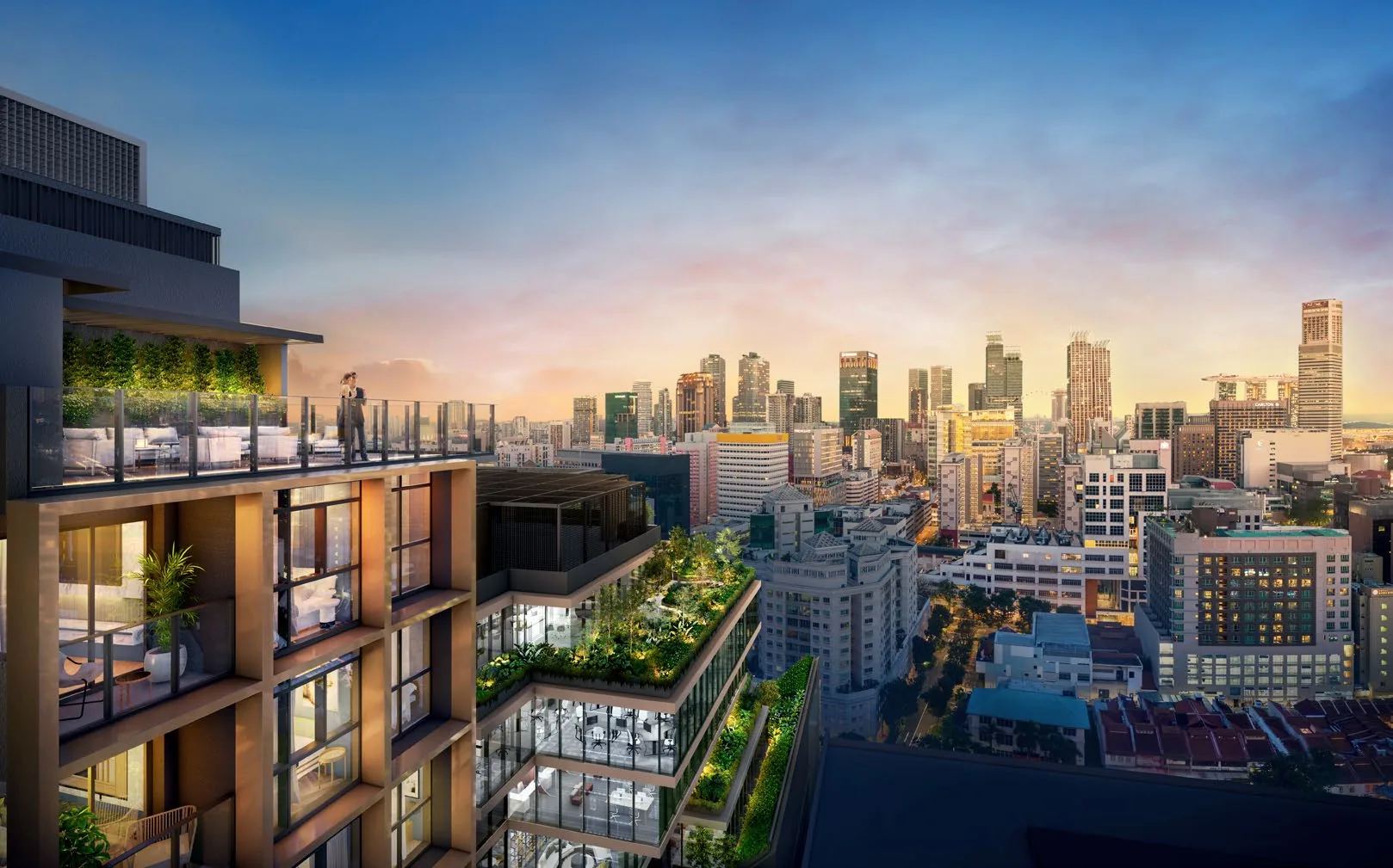
 Artist’s impression
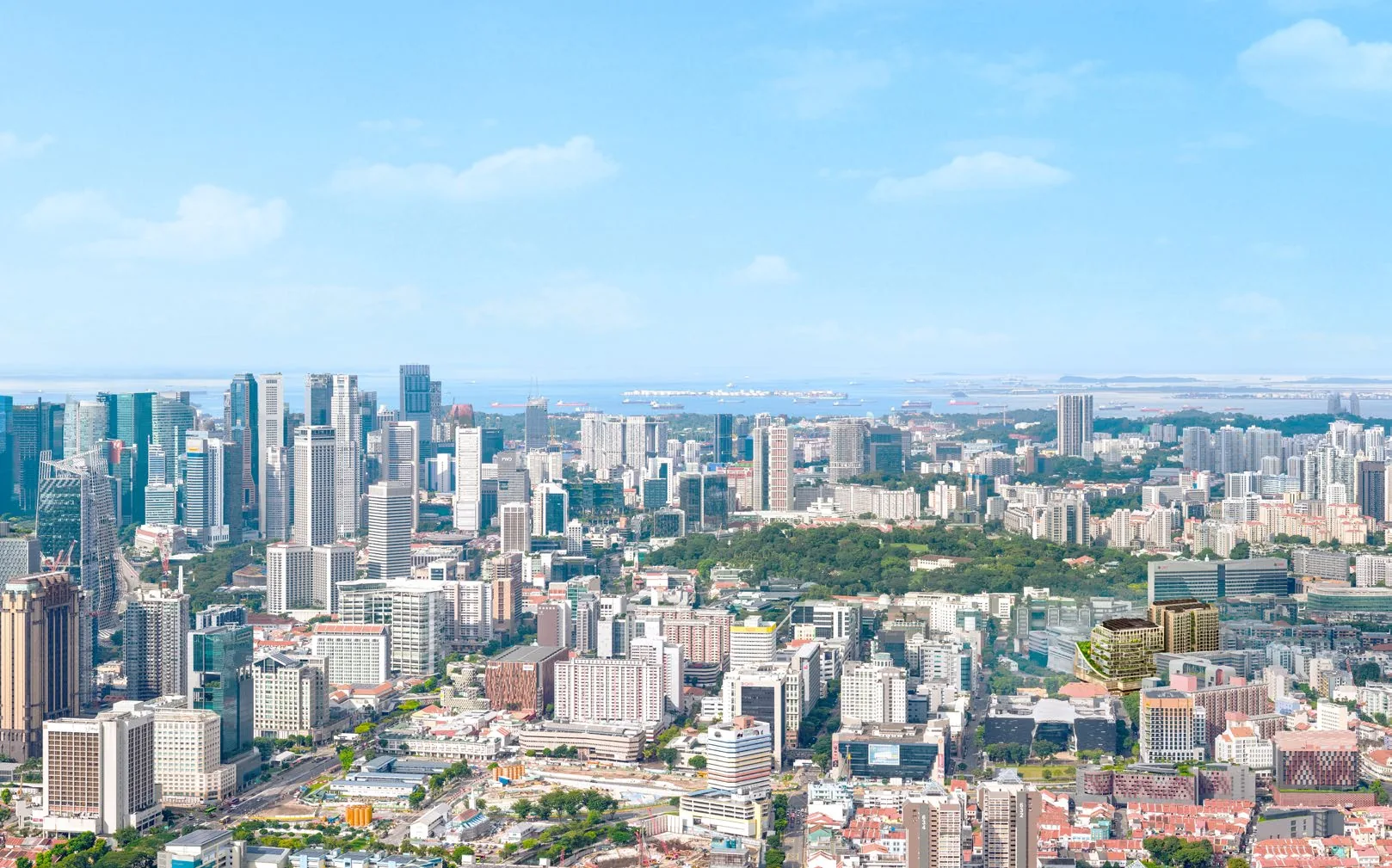
The Collective at One Sophia stands at 1A and 1B Sophia Road, District 9, on the former Peace Centre site at the corner of Selegie Road and Middle Road. Bencoolen MRT station is about 500 metres away on foot, and four more stations are within about 650 metres.
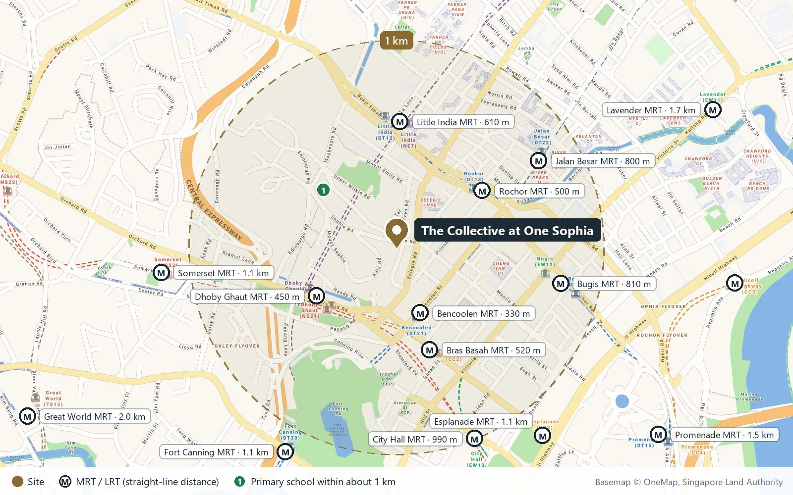
The Collective at One Sophia Location Map
Map centred on The Collective at One Sophia, Sophia Road (1.30151, 103.84901). Open The Collective at One Sophia in Google Maps.
The One Sophia site is a triangle of streets. Sophia Road runs along its western edge, climbing gently towards Mount Emily; Selegie Road, the main road between Dhoby Ghaut and Little India, runs along its eastern edge; and Middle Road meets the two at the southern tip, leading towards Bencoolen Street, the arts schools and Bugis. The residential blocks and their drop-off face Sophia Road, the quieter of the three.
The Collective at One Sophia Distances
The distances below are straight-line measurements from the site on OneMap; walking routes are longer. They show how much of the city centre lies within a short walk of The Collective at One Sophia, from five MRT stations and the arts schools to the museums, Little India and Orchard Road.
Within about 550 metres
| Destination | Straight-line distance |
|---|---|
| School of the Arts (SOTA) | about 230 m |
| Bencoolen MRT station (DT21) | about 310 m |
| NAFA (Bencoolen Street campus) | about 320 m |
| LASALLE College of the Arts (McNally Street) | about 320 m |
| Mount Emily Park | about 380 m |
| Dhoby Ghaut MRT station | about 390 m |
| Bras Basah MRT station (CC2) | about 440 m |
| St. Margaret’s School (Primary) | about 450 m |
| Plaza Singapura | about 460 m |
| Rochor MRT station (DT13) | about 460 m |
| Little India MRT station | about 470 m |
| Sim Lim Square | about 470 m |
| National Museum of Singapore | about 530 m |
| Singapore Management University | about 540 m |
| Tekka Centre | about 550 m |
About 0.55 to 2.2 kilometres
| Destination | Straight-line distance |
|---|---|
| Albert Centre Market & Food Centre | about 570 m |
| National Design Centre | about 590 m |
| Istana Park | about 630 m |
| Bugis Street | about 640 m |
| National Library Building | about 710 m |
| Bras Basah Complex | about 720 m |
| Bugis MRT station | about 750 m |
| Bugis Junction | about 750 m |
| Fort Canning Park | about 780 m |
| Raffles City Shopping Centre | about 950 m |
| KK Women’s and Children’s Hospital | about 1.04 km |
| ION Orchard | about 1.9 km |
| Raffles Place MRT station | about 1.9 km |
| Marina Bay Sands | about 2.2 km |
Measured on OneMap (SLA) from the site. School distances should be confirmed with the MOE SchoolFinder.
The neighbourhood around The Collective at One Sophia
The site sits where three quarters touch: the arts and heritage precinct of Bras Basah and Bugis to the south, the shopping streets of Dhoby Ghaut and Orchard Road to the west, and Little India to the north. The developer’s brochure calls it a one-stop lifestyle destination, and in daily terms that means groceries, hawker food, malls, galleries and green space are all within walking distance.
Five area guides look further: the arts precinct, the five MRT stations, schools nearby, shopping and dining and parks nearby.
Request The Collective at One Sophia Price List
The Collective at One Sophia is open for sale, and the Sales Concierge sends the current price list with the homes still available by stack. Showflat viewings are arranged by appointment through the Sales Concierge.
Sent on request
- The current price list with the available units by stack.
- The e-brochure and every floor plan, from 431 to 1,249 sq ft.
- The unit distribution chart, placing each home in Block 1A or 1B.
- A worked payment schedule and the stamp duty for your profile.
- A showflat appointment arranged around your diary.
Request the Price List
No obligation. The Sales Concierge responds personally to every enquiry.
Prefer to speak to someone? Call +65 6200 6220, or send a WhatsApp message to the same number.